Collections
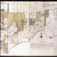
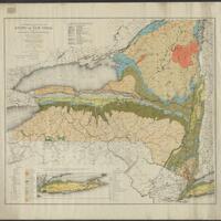
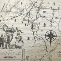
A collection of late 18th century and early 19th century maps, particularly of Western New York and Pennsylvania, created for the Holland Land Company.
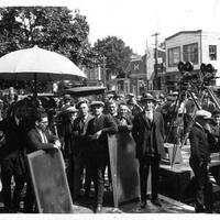
A sampling of early legal documents and photographs from the town of Huntington’s archives.
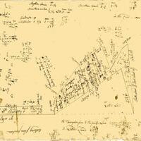
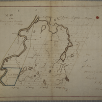
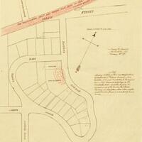
Historical maps showing land purchases and boundaries in the Town of Huntington.
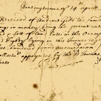
Legal manuscripts of early Huntington, NY.
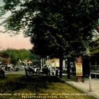
Historic postcards from Huntington, NY.
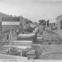
This collection contains photographs of the village of Ilion, New York that were affected by an urban revitalization project conducted from 1968-1972.
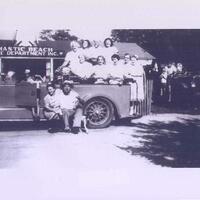
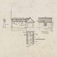
Photographs, maps, and postcards documenting the history of Mastic Beach, NY.
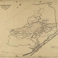
Oversized maps related to the Town of Tuxedo and Orange County.
This collection of maps comes from the MacIntyre Iron Company, which operated at the Tahawus mines near Newcomb, NY.
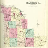
An atlas of Madison County, New York published by Alexander Pomeroy in 1875.
The maps (and, for some, associated documents) in this digital collection represent a portion of the 300+ in the physical Wadsworth collection and cover areas within townships, tracts, and counties in the Genesee Valley region.
Heart's Delight Farm in Chazy, New York was a state-of-the-art farm in the early 20th century. This collection includes blueprints and maps depicting the farm and its buildings.
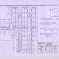
Historical maps from Mastic, Mastic Beach, Shirley, Brookhaven, and Moriches communities on Long Island
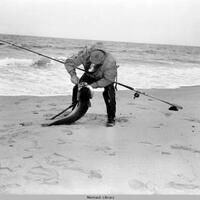
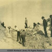
Historic photographs and maps showing land development in Montauk.
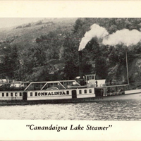
Photographic and illustrated postcards relating to Naples, New York in the Finger Lakes region. In particular, the images highlight the natural features of the area, especially Canandaigua Lake throughout the early to mid-20th century.
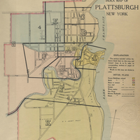
This collection contains the New Atlas of the City of Plattsburgh from 1916.

Photographs of historic places and architecture in the community of New Hartford, New York.
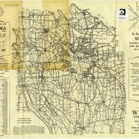
A rural directory for locating farms and agricultural property in Onondaga County and a 1938 Map of Onondaga County.
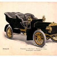
Materials relating to Thomas Flyer automobiles and the New York to Paris Race in the early 20th century.
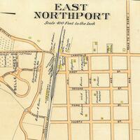
Historical maps of the Northport-East Northport community.
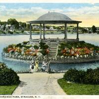
A collection of postcards portraying Onondaga Park in the early 20th century.