The national trend of building suburban developments to replace downtown shopping districts and urban residences was encouraged by federal Urban Renewal policies. These policies provided funding opportunities for localities and developers to build outside of city centers in the 1960s and 1970s. This popular approach to city planning dovetailed with the destruction of Southern Tier communities caused by the 1972 flood.
For example, there had already been plans for a "renewal" of Corning’s downtown district when the flood struck. The destruction made it necessary to quickly implement new plans. The Market Street Restoration Society undertook the efforts to restore the 19th Century architecture on the western half of Market Street, while the buildings on the east end that had been damaged were torn down. A new civic district was built in its place. This is the current home of the Southeast Steuben County Library, City Hall, city administration offices, and police headquarters. The old City Hall building is now the Rockwell Museum.
Elmira's experience with urban renewal was less successful. Storefronts downtown were overwhelmingly wiped out by the flood, while the unflooded suburban malls benefited from the natural disaster as residents needed to replace many of their possessions. Elmira's commercial district has never recovered to its pre-Agnes bustle.
Market Street. Courtesy of the Corning-Painted Post Historical Society and Steuben County Historical Society.
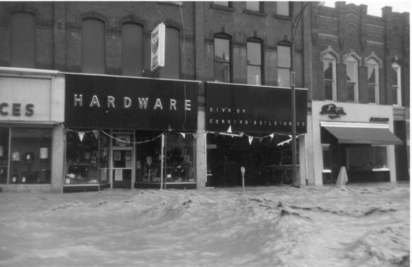
Market Street in Corning had already been considered for urban renewal when its bars and department stores bore the brunt of the flooding. These stores were only a few blocks from the river.
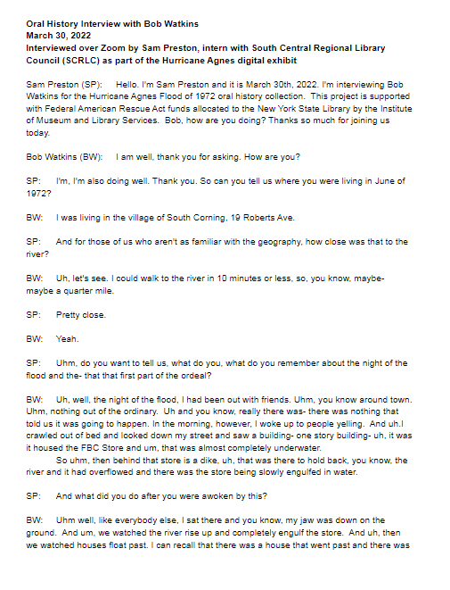
Flood of 1972 Interview with Bob Watkins. Courtesy of the South Central Regional Library Council.
Bob Watkins, who grew up in Corning, recalled the change on Market Street especially. He remembered that before the flood, Market Street was well-known for having a bar crawl, with dozens of establishments. He described the block as becoming "sterile" once it was built back.
(Of note, he also remembers dazedly walking on Market Street right after the flood and coming across a six-foot-long carp!)

Map of Corning with areas marked for architectural review. Courtesy of the Steuben County Historical Society.
This map shows areas of Corning that needed architectural review. City planners had to rapidly assess the damage to city blocks and decide what to condemn and what to rebuild. The area labeled “2” is the Corning Museum of Glass.
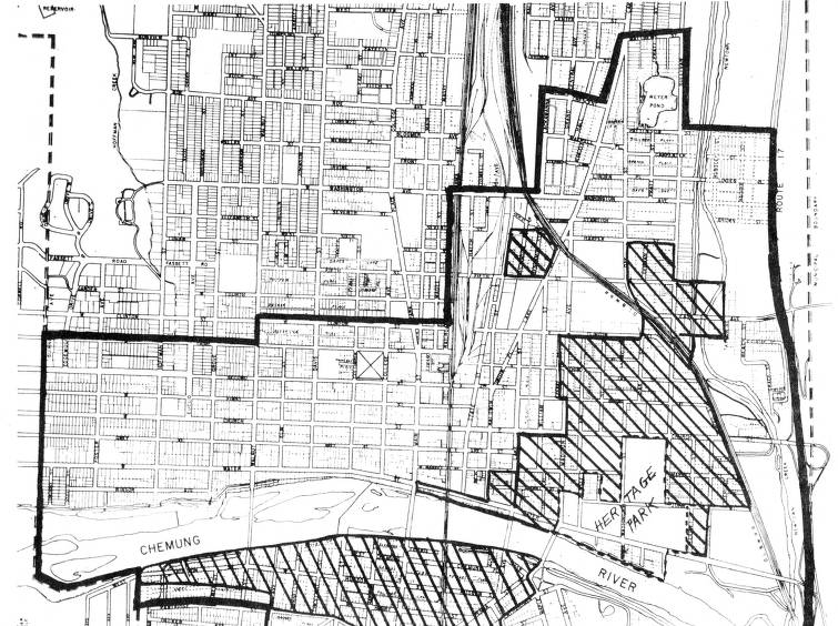
Map of Elmira's north side with areas marked for review and urban renewal. Courtesy of the Steuben County Historical Society.
These two maps show the extent of the flooding and damage to downtown Elmira. Both sides of the river were under water for several blocks.
In addition to the damage to the buildings on the shores of the river, all four bridges downtown and the railroad bridge were lost to the flooding.
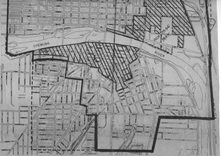
Map of Elmira's south side with areas marked for review and urban renewal. Courtesy of the Steuben County Historical Society.
The New York State Urban Development Corporation was put in charge of redesigning the damaged areas. The resulting “New Elmira Plan” did not involve rebuilding the downtown commercial district. The damaged buildings along Water Street were torn down and turned into a riverfront park. The resulting loss of 40% of Elmira’s downtown commercial space depressed the city’s regrowth after the flood.
This added to the detrimental effects of the national economic recession, in which companies like Remington Rand left the area and laid off its 690 employees, just months before the flood.
Additionally, because the Erie-Lackawanna Railroad and the Elmira and Williamsport Railroad declared bankruptcy, the City of Elmira was further deprived of commercial opportunity and development.
As of 2021, 24.9% of Elmira’s residents lived below the poverty line, 10% higher than the average for the rest of the county. Elmira’s population has declined by 33% since 1970.
Still frame from Agnes: The Flood of '72. Courtesy of WSKG's Upstate History Documentaries program.
In this documentary, created by the local PBS station for the 40th anniversary of Hurricane Agnes and the flooding, Elmira residents recall how busy and popular the downtown shopping district was in the 1960s.
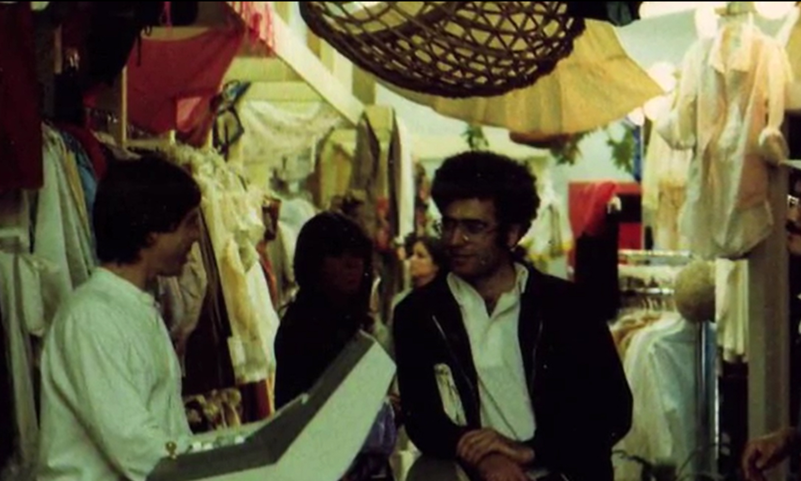
Tommy Hilfiger, who would later become an internationally famous designer, grew up in Elmira. At the age of 18, he opened a popular store called The People's Place in 1969, bringing hip fashions and decor from New York City to the Southern Tier. He recalls the night before the flooding, when all of his friends helped carry his merchandise from the vulnerable basement storefront to higher floors in the building. Because of that effort, his was one of very few businesses that still had sellable merchandise in the weeks following the flood.
The building where The People's Place was located has since been torn down and replaced by the First Arena on West Gray Street.

Map of the planned shopping center for Painted Post Village Square. Courtesy of the Corning-Painted Post Historical Society and Steuben County Historical Society.
This $6.4 million shopping center replaced the area behind Tillman’s Pharmacy in Painted Post. Tillman's and the rest of the commercial area in Painted Post was severely flooded in 1972.
The city planners worked quickly to implement a new reconstruction project. In just 28 months, merchants moved into a new mall and residents into a new apartment complex.
A contemporary (1976) New York Times article noted that not everyone was excited for the new 26-acre development:
"Some merchants did not want to give up their buildings, several of which dated from the last century. Some who accepted the demolition and the reconstruction wanted the town to acquire a “colonial” look instead of the ultimate design of the mall, whose cluster of six stores are faced with unpainted vertical planks that give it a vaguely wild‐West look."
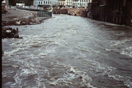
Flooded Owasco River in Downtown Auburn. Courtesy of the Seymour Public Library District.
This view of Auburn is nearly unrecognizable today. This photograph shows the swollen Owasco River along Loop Road, which was still being built in 1972. The view is from Genesee Street, facing the North Street bridge. Buildings along the side of the river were already in the process of being razed as part of Urban Renewal efforts.